
Aschaffenburg
Bismarckallee 1, 63739 Aschaffenburg, Deutschland
Spessartweg 1 | Stages & Map
The Spessartweg 1 is one of the most well-known long-distance hiking trails in the Spessart region, connecting Aschaffenburg with Gemünden am Main. Official tourism sources describe it as a quality trail that follows the paths of princes, teamsters, and pilgrims, starting in the Aschaffenburg Fasanerie and leading through a landscape of forests, monasteries, castles, sunken paths, and views of the Main. Depending on the source, the distance is indicated as approximately 59 to 62 kilometers; it is also described as easily planable in three to four stages. This is particularly practical for hikers, as daily stages, travel, and overnight stays can be flexibly coordinated. ([spessartweg.de](https://www.spessartweg.de/spessartweg-1/wegbeschreibung.html))
It is precisely the combination of historical backdrop and natural trail guidance that makes this path appealing. The start in Aschaffenburg is not an inconspicuous entry point, but a section with scenic character: the Fasanerie marks the transition into open countryside, the path is marked from the main train station and initially leads towards Teufelskanzel and Kloster Schmerlenbach. After that, the scenery changes from city to forest, from slopes to meadows, and later back to Main towns like Lohr and Gemünden. For those looking for a multi-day tour, this is not an artificially staged circular route, but a genuine crossing of the Spessart from west to east. ([aschaffenburg.de](https://www.aschaffenburg.de/Freizeit-Tourismus/Sport-und-Freizeit/index.php?FID=4173.12292.1&La=1&ModID=7&NavID=4173.871&object=tx%7C4173.5.1&utm_source=openai))
Stages, Length, and Elevation Profile of Spessartweg 1
For SEO searches regarding stages, Spessartweg 1 is particularly grateful, as the official pages structure it on several levels. The Spessartweg page recommends the trail in practice to be well planned in three to four stages, while the hiking portal of the German Hiking Association divides the entire route into four stages. There, Stage 1 starts in Aschaffenburg and leads to Haibach, Stage 2 runs from Haibach to Rothenbuch, and Stage 4 extends from Lohr-Mariabuchen to Gemünden. This is helpful for planning, as both shorter and longer daily stages can be put together. ([spessartweg.de](https://www.spessartweg.de/spessartweg-1/etappen.html))
Content-wise, the division fits well with the terrain. The official trail text emphasizes that Spessartweg 1 initially orients itself to significant natural and cultural points after starting in the Fasanerie, before diving into the vast sea of leaves of the Spessart. The stages are shown by the official site with recommended months throughout the year, which in practice suggests that the trail remains fundamentally interesting across seasons and that the difficulty arises more from distance, elevation gain, and personal fitness than from a narrow seasonal closure. For ambitious day hikers, the format is as exciting as for multi-day tours with overnight stays. ([wanderbares-deutschland.de](https://www.wanderbares-deutschland.de/wege/alle-wege/spessartweg-1-etappe-2-von-haibach-bis-rothenbuch-a187b69748))
Map, GPX, and Orientation on Spessartweg 1
Those looking for a map or GPX usually want to know quickly how the trail can be prepared digitally. This is exactly where the official pages provide good foundations: On the FrankenTourismus page, a GPX download is mentioned for Spessartweg 1, and there is also the tour view with data about the trail. The Spessartweg page additionally refers to topographic maps at a scale of 1:25,000 and names for Spessartweg 1 the sheets 2-Lohr a. Main, 7-Aschaffenburg, and 10-Heigenbrücken; in smaller sections, 1-Gemünden and 3-Frammersbach are also useful. This is particularly valuable for those who do not want to rely solely on an app but are out with a classic hiking map and precise route planning. ([frankentourismus.de](https://www.frankentourismus.de/wege/spessartweg_1-389/))
Digital orientation is complemented by trail marking. According to the trail description, Spessartweg 1 is marked from the Aschaffenburg main train station and runs to Gemünden; there it ends at the marketplace and is marked to the train station. In practice, this means: Those heading to the starting point can easily find the entry, and those arriving at the destination have a clear connection to public transport. The fact that the official pages offer a map, audio stations, and tour details is a strong signal for anyone wanting to get a precise picture in advance. ([spessartweg.de](https://www.spessartweg.de/spessartweg-1/wegbeschreibung.html))
Start in the Fasanerie Aschaffenburg: Access and Entry
The Fasanerie is much more than just a starting point with a name on the map. The city of Aschaffenburg describes it as a nature-friendly managed park forest with elements of a landscape garden, forming the transition into open countryside. This is precisely where the emotional strength of Spessartweg 1 comes into play: You do not simply leave the city, but immerse yourself in a historic green corridor that connects walks, forest edges, and a developed park landscape. For those searching for Spessartweg 1 Aschaffenburg or Spessartweg 1 access, this is the crucial information: The entry is at the edge of the city, not somewhere abstract in the Spessart, but at a concrete, easily graspable location. ([aschaffenburg.de](https://www.aschaffenburg.de/Freizeit-Tourismus/Sport-und-Freizeit/index.php?FID=4173.12292.1&La=1&ModID=7&NavID=4173.871&object=tx%7C4173.5.1&utm_source=openai))
It is also practical that the trail is marked from the Aschaffenburg main train station. So, if you arrive by train, you have clear orientation to the actual start in the Fasanerie. The FrankenTourismus page additionally states that a round trip by public transport is possible. This makes the trail particularly attractive for hikers without a car, but also for those who prefer a one-way tour with train connections. With this mix of marked entry, easily accessible city start, and clear destination connection, Spessartweg 1 is a classic long-distance hiking trail that can be very smoothly integrated into travel planning. ([frankentourismus.de](https://www.frankentourismus.de/wege/spessartweg_1-389/))
The First Kilometers to Schmerlenbach and Rothenbuch
The route thrives on its stations. Even in the first section, Teufelskanzel, a large service tree, the Hohe Kreuz, and the remains of the Ketzelburg are mentioned. Then follows Kloster Schmerlenbach, which has become a well-known pilgrimage destination due to its Mother of God. For those who do not want to separate landscape and culture while hiking, both can be found here in close proximity: rock formations, pilgrimage tradition, and a historic site with spiritual radiance. Later, the path leads through forests, past forest lakes and meadows, before Rothenbuch with its castle sets another defining stage destination. These early sections are particularly important because they set the tone for the entire trail and show that Spessartweg 1 is not just a linear connection, but a sequence of experiences. ([spessartweg.de](https://www.spessartweg.de/spessartweg-1/wegbeschreibung.html))
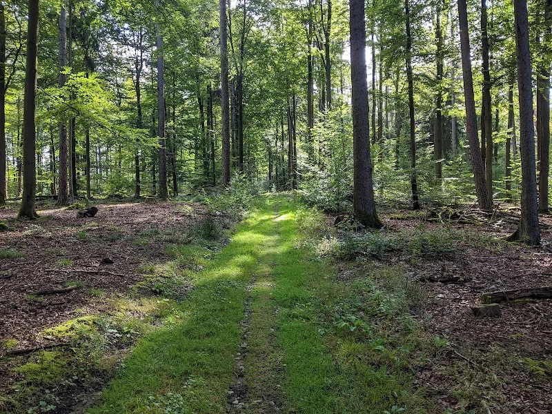
Also for the search terms related to photos and reviews, this part of the trail is exciting because the first kilometers reveal a lot about the character of the trail. You get open views, shady forest passages, and places with history. The audio stations pick up on these points and tell stories about Fasanerie, Teufelskanzel, Kloster Schmerlenbach, and other stations. This is a valuable hint for SEO considerations: Those planning the trail are not only looking for elevation gains but for images in their minds, for atmosphere, and for a route that can be told in stages. Spessartweg 1 fulfills this need very well, as it already creates a strong change between nature and culture in the first kilometers. ([spessartweg.de](https://www.spessartweg.de/spessartweg-1/hoerstationen.html))
Lohr, Mariabuchen, and Gemünden: the Marked Destinations at the End
Especially striking are the sections along the Main. In Lohr a. Main, the Kurmainz Castle with the Spessart Museum, the old town hall, and the Franconian old town with the fishermen's quarter attract visitors. After that, Spessartweg 1 leaves the Main again and leads to the pilgrimage site of Mariabuchen, where the monastery and church cling to a steep slope. From there, it continues to the ruins of Schönrain with a view into the Main valley, before reaching Gemünden as a three-river town and endpoint of the trail. For visitors looking for photos or highlights, it is precisely this mix of historical buildings, quiet forest areas, and wide views that makes the trail seem so varied. ([spessartweg.de](https://www.spessartweg.de/spessartweg-1/wegbeschreibung.html))
The final section of the trail is particularly attractive because it condenses the dramaturgy of the entire route once again. The view into the Main valley, the ruins of Schönrain, and the approach to Gemünden make it clear that the trail does not consist solely of forest paths, but leads to a deliberately set goal. This is precisely where it becomes evident why Spessartweg 1 is more than just a simple long-distance hiking trail for many hikers: The stations are different, but they are interconnected, and in the end, a journey is created that is very memorable. Those planning the tour should take their time in this section, as the last kilometers often provide the most impressive motifs and the strongest images for personal hiking stories. ([wanderbares-deutschland.de](https://www.wanderbares-deutschland.de/wege/alle-wege/spessartweg-1-von-fuersten-fuhrleuten-und-pilgern-9ec6050f49))
Quality Trail, Audio Stations, Photos, and Practical Hiking Tips
Spessartweg 1 is one of the trails that not only runs beautifully but is also officially recognized for its quality. The trail's pages mention the Quality Trail Wanderbares Deutschland seal since 2005 or 2006, and the hiking portal classifies the trail as a certified quality trail. This fits well with the description of natural paths, sunken paths, forests, and cultural-historical stations. Although different sources indicate the length slightly differently, the line is clear: Spessartweg 1 is an established, repeatedly recognized long-distance hiking trail characterized by good marking and strong scenic dramaturgy. For search queries like Spessartweg 1 quality hiking trail, this is the central answer. ([spessartweg.de](https://www.spessartweg.de/spessartweg-1/wegbeschreibung.html))
Another detail that makes the trail special is the audio stations. There are officially 15 stations, including those for Fasanerie, Teufelskanzel, Kloster Schmerlenbach, Rothenbuch, Weikertswiese, Klapper, Lohr a. Main, Mariabuchen, the ruins of Schönrain, and Gemünden. This shows how strongly the trail relies on stories, landscapes, and local experiences. In practice, this means: Those planning the tour should not only focus on distance and map but also plan time for short breaks at special points. The official stage pages also provide recommendations for all months; this speaks for a trail that can be included in hiking planning not only in high summer but year-round. ([spessartweg.de](https://www.spessartweg.de/spessartweg-1/hoerstationen.html))
Those looking for photos usually seek impressions from exactly this tension field: forest and open view, quiet places and marked destinations, cultural monument and nature path. This is where its SEO potential lies. The search terms related to map, GPX, stages, and reviews show that interested parties primarily want orientation and a sense of the trail before they set off. Spessartweg 1 fulfills this need well, as it is digitally planable, clearly marked, and so varied in landscape that one can almost trace the course through individual images. Those who ultimately hike the trail as a multi-day tour benefit from the combination of train connections, stage structure, and cultural intermediate destinations. Thus, a search for Spessartweg 1 map or Spessartweg 1 gpx becomes not only a digital preparation but a realistically planable hiking vacation in the Spessart. ([frankentourismus.de](https://www.frankentourismus.de/wege/spessartweg_1-389/))
Sources:
Mehr anzeigenWeniger anzeigen
Spessartweg 1 | Stages & Map
The Spessartweg 1 is one of the most well-known long-distance hiking trails in the Spessart region, connecting Aschaffenburg with Gemünden am Main. Official tourism sources describe it as a quality trail that follows the paths of princes, teamsters, and pilgrims, starting in the Aschaffenburg Fasanerie and leading through a landscape of forests, monasteries, castles, sunken paths, and views of the Main. Depending on the source, the distance is indicated as approximately 59 to 62 kilometers; it is also described as easily planable in three to four stages. This is particularly practical for hikers, as daily stages, travel, and overnight stays can be flexibly coordinated. ([spessartweg.de](https://www.spessartweg.de/spessartweg-1/wegbeschreibung.html))
It is precisely the combination of historical backdrop and natural trail guidance that makes this path appealing. The start in Aschaffenburg is not an inconspicuous entry point, but a section with scenic character: the Fasanerie marks the transition into open countryside, the path is marked from the main train station and initially leads towards Teufelskanzel and Kloster Schmerlenbach. After that, the scenery changes from city to forest, from slopes to meadows, and later back to Main towns like Lohr and Gemünden. For those looking for a multi-day tour, this is not an artificially staged circular route, but a genuine crossing of the Spessart from west to east. ([aschaffenburg.de](https://www.aschaffenburg.de/Freizeit-Tourismus/Sport-und-Freizeit/index.php?FID=4173.12292.1&La=1&ModID=7&NavID=4173.871&object=tx%7C4173.5.1&utm_source=openai))
Stages, Length, and Elevation Profile of Spessartweg 1
For SEO searches regarding stages, Spessartweg 1 is particularly grateful, as the official pages structure it on several levels. The Spessartweg page recommends the trail in practice to be well planned in three to four stages, while the hiking portal of the German Hiking Association divides the entire route into four stages. There, Stage 1 starts in Aschaffenburg and leads to Haibach, Stage 2 runs from Haibach to Rothenbuch, and Stage 4 extends from Lohr-Mariabuchen to Gemünden. This is helpful for planning, as both shorter and longer daily stages can be put together. ([spessartweg.de](https://www.spessartweg.de/spessartweg-1/etappen.html))
Content-wise, the division fits well with the terrain. The official trail text emphasizes that Spessartweg 1 initially orients itself to significant natural and cultural points after starting in the Fasanerie, before diving into the vast sea of leaves of the Spessart. The stages are shown by the official site with recommended months throughout the year, which in practice suggests that the trail remains fundamentally interesting across seasons and that the difficulty arises more from distance, elevation gain, and personal fitness than from a narrow seasonal closure. For ambitious day hikers, the format is as exciting as for multi-day tours with overnight stays. ([wanderbares-deutschland.de](https://www.wanderbares-deutschland.de/wege/alle-wege/spessartweg-1-etappe-2-von-haibach-bis-rothenbuch-a187b69748))
Map, GPX, and Orientation on Spessartweg 1
Those looking for a map or GPX usually want to know quickly how the trail can be prepared digitally. This is exactly where the official pages provide good foundations: On the FrankenTourismus page, a GPX download is mentioned for Spessartweg 1, and there is also the tour view with data about the trail. The Spessartweg page additionally refers to topographic maps at a scale of 1:25,000 and names for Spessartweg 1 the sheets 2-Lohr a. Main, 7-Aschaffenburg, and 10-Heigenbrücken; in smaller sections, 1-Gemünden and 3-Frammersbach are also useful. This is particularly valuable for those who do not want to rely solely on an app but are out with a classic hiking map and precise route planning. ([frankentourismus.de](https://www.frankentourismus.de/wege/spessartweg_1-389/))
Digital orientation is complemented by trail marking. According to the trail description, Spessartweg 1 is marked from the Aschaffenburg main train station and runs to Gemünden; there it ends at the marketplace and is marked to the train station. In practice, this means: Those heading to the starting point can easily find the entry, and those arriving at the destination have a clear connection to public transport. The fact that the official pages offer a map, audio stations, and tour details is a strong signal for anyone wanting to get a precise picture in advance. ([spessartweg.de](https://www.spessartweg.de/spessartweg-1/wegbeschreibung.html))
Start in the Fasanerie Aschaffenburg: Access and Entry
The Fasanerie is much more than just a starting point with a name on the map. The city of Aschaffenburg describes it as a nature-friendly managed park forest with elements of a landscape garden, forming the transition into open countryside. This is precisely where the emotional strength of Spessartweg 1 comes into play: You do not simply leave the city, but immerse yourself in a historic green corridor that connects walks, forest edges, and a developed park landscape. For those searching for Spessartweg 1 Aschaffenburg or Spessartweg 1 access, this is the crucial information: The entry is at the edge of the city, not somewhere abstract in the Spessart, but at a concrete, easily graspable location. ([aschaffenburg.de](https://www.aschaffenburg.de/Freizeit-Tourismus/Sport-und-Freizeit/index.php?FID=4173.12292.1&La=1&ModID=7&NavID=4173.871&object=tx%7C4173.5.1&utm_source=openai))
It is also practical that the trail is marked from the Aschaffenburg main train station. So, if you arrive by train, you have clear orientation to the actual start in the Fasanerie. The FrankenTourismus page additionally states that a round trip by public transport is possible. This makes the trail particularly attractive for hikers without a car, but also for those who prefer a one-way tour with train connections. With this mix of marked entry, easily accessible city start, and clear destination connection, Spessartweg 1 is a classic long-distance hiking trail that can be very smoothly integrated into travel planning. ([frankentourismus.de](https://www.frankentourismus.de/wege/spessartweg_1-389/))
The First Kilometers to Schmerlenbach and Rothenbuch
The route thrives on its stations. Even in the first section, Teufelskanzel, a large service tree, the Hohe Kreuz, and the remains of the Ketzelburg are mentioned. Then follows Kloster Schmerlenbach, which has become a well-known pilgrimage destination due to its Mother of God. For those who do not want to separate landscape and culture while hiking, both can be found here in close proximity: rock formations, pilgrimage tradition, and a historic site with spiritual radiance. Later, the path leads through forests, past forest lakes and meadows, before Rothenbuch with its castle sets another defining stage destination. These early sections are particularly important because they set the tone for the entire trail and show that Spessartweg 1 is not just a linear connection, but a sequence of experiences. ([spessartweg.de](https://www.spessartweg.de/spessartweg-1/wegbeschreibung.html))
Also for the search terms related to photos and reviews, this part of the trail is exciting because the first kilometers reveal a lot about the character of the trail. You get open views, shady forest passages, and places with history. The audio stations pick up on these points and tell stories about Fasanerie, Teufelskanzel, Kloster Schmerlenbach, and other stations. This is a valuable hint for SEO considerations: Those planning the trail are not only looking for elevation gains but for images in their minds, for atmosphere, and for a route that can be told in stages. Spessartweg 1 fulfills this need very well, as it already creates a strong change between nature and culture in the first kilometers. ([spessartweg.de](https://www.spessartweg.de/spessartweg-1/hoerstationen.html))
Lohr, Mariabuchen, and Gemünden: the Marked Destinations at the End
Especially striking are the sections along the Main. In Lohr a. Main, the Kurmainz Castle with the Spessart Museum, the old town hall, and the Franconian old town with the fishermen's quarter attract visitors. After that, Spessartweg 1 leaves the Main again and leads to the pilgrimage site of Mariabuchen, where the monastery and church cling to a steep slope. From there, it continues to the ruins of Schönrain with a view into the Main valley, before reaching Gemünden as a three-river town and endpoint of the trail. For visitors looking for photos or highlights, it is precisely this mix of historical buildings, quiet forest areas, and wide views that makes the trail seem so varied. ([spessartweg.de](https://www.spessartweg.de/spessartweg-1/wegbeschreibung.html))
The final section of the trail is particularly attractive because it condenses the dramaturgy of the entire route once again. The view into the Main valley, the ruins of Schönrain, and the approach to Gemünden make it clear that the trail does not consist solely of forest paths, but leads to a deliberately set goal. This is precisely where it becomes evident why Spessartweg 1 is more than just a simple long-distance hiking trail for many hikers: The stations are different, but they are interconnected, and in the end, a journey is created that is very memorable. Those planning the tour should take their time in this section, as the last kilometers often provide the most impressive motifs and the strongest images for personal hiking stories. ([wanderbares-deutschland.de](https://www.wanderbares-deutschland.de/wege/alle-wege/spessartweg-1-von-fuersten-fuhrleuten-und-pilgern-9ec6050f49))
Quality Trail, Audio Stations, Photos, and Practical Hiking Tips
Spessartweg 1 is one of the trails that not only runs beautifully but is also officially recognized for its quality. The trail's pages mention the Quality Trail Wanderbares Deutschland seal since 2005 or 2006, and the hiking portal classifies the trail as a certified quality trail. This fits well with the description of natural paths, sunken paths, forests, and cultural-historical stations. Although different sources indicate the length slightly differently, the line is clear: Spessartweg 1 is an established, repeatedly recognized long-distance hiking trail characterized by good marking and strong scenic dramaturgy. For search queries like Spessartweg 1 quality hiking trail, this is the central answer. ([spessartweg.de](https://www.spessartweg.de/spessartweg-1/wegbeschreibung.html))
Another detail that makes the trail special is the audio stations. There are officially 15 stations, including those for Fasanerie, Teufelskanzel, Kloster Schmerlenbach, Rothenbuch, Weikertswiese, Klapper, Lohr a. Main, Mariabuchen, the ruins of Schönrain, and Gemünden. This shows how strongly the trail relies on stories, landscapes, and local experiences. In practice, this means: Those planning the tour should not only focus on distance and map but also plan time for short breaks at special points. The official stage pages also provide recommendations for all months; this speaks for a trail that can be included in hiking planning not only in high summer but year-round. ([spessartweg.de](https://www.spessartweg.de/spessartweg-1/hoerstationen.html))
Those looking for photos usually seek impressions from exactly this tension field: forest and open view, quiet places and marked destinations, cultural monument and nature path. This is where its SEO potential lies. The search terms related to map, GPX, stages, and reviews show that interested parties primarily want orientation and a sense of the trail before they set off. Spessartweg 1 fulfills this need well, as it is digitally planable, clearly marked, and so varied in landscape that one can almost trace the course through individual images. Those who ultimately hike the trail as a multi-day tour benefit from the combination of train connections, stage structure, and cultural intermediate destinations. Thus, a search for Spessartweg 1 map or Spessartweg 1 gpx becomes not only a digital preparation but a realistically planable hiking vacation in the Spessart. ([frankentourismus.de](https://www.frankentourismus.de/wege/spessartweg_1-389/))
Sources:
Spessartweg 1 | Stages & Map
The Spessartweg 1 is one of the most well-known long-distance hiking trails in the Spessart region, connecting Aschaffenburg with Gemünden am Main. Official tourism sources describe it as a quality trail that follows the paths of princes, teamsters, and pilgrims, starting in the Aschaffenburg Fasanerie and leading through a landscape of forests, monasteries, castles, sunken paths, and views of the Main. Depending on the source, the distance is indicated as approximately 59 to 62 kilometers; it is also described as easily planable in three to four stages. This is particularly practical for hikers, as daily stages, travel, and overnight stays can be flexibly coordinated. ([spessartweg.de](https://www.spessartweg.de/spessartweg-1/wegbeschreibung.html))
It is precisely the combination of historical backdrop and natural trail guidance that makes this path appealing. The start in Aschaffenburg is not an inconspicuous entry point, but a section with scenic character: the Fasanerie marks the transition into open countryside, the path is marked from the main train station and initially leads towards Teufelskanzel and Kloster Schmerlenbach. After that, the scenery changes from city to forest, from slopes to meadows, and later back to Main towns like Lohr and Gemünden. For those looking for a multi-day tour, this is not an artificially staged circular route, but a genuine crossing of the Spessart from west to east. ([aschaffenburg.de](https://www.aschaffenburg.de/Freizeit-Tourismus/Sport-und-Freizeit/index.php?FID=4173.12292.1&La=1&ModID=7&NavID=4173.871&object=tx%7C4173.5.1&utm_source=openai))
Stages, Length, and Elevation Profile of Spessartweg 1
For SEO searches regarding stages, Spessartweg 1 is particularly grateful, as the official pages structure it on several levels. The Spessartweg page recommends the trail in practice to be well planned in three to four stages, while the hiking portal of the German Hiking Association divides the entire route into four stages. There, Stage 1 starts in Aschaffenburg and leads to Haibach, Stage 2 runs from Haibach to Rothenbuch, and Stage 4 extends from Lohr-Mariabuchen to Gemünden. This is helpful for planning, as both shorter and longer daily stages can be put together. ([spessartweg.de](https://www.spessartweg.de/spessartweg-1/etappen.html))
Content-wise, the division fits well with the terrain. The official trail text emphasizes that Spessartweg 1 initially orients itself to significant natural and cultural points after starting in the Fasanerie, before diving into the vast sea of leaves of the Spessart. The stages are shown by the official site with recommended months throughout the year, which in practice suggests that the trail remains fundamentally interesting across seasons and that the difficulty arises more from distance, elevation gain, and personal fitness than from a narrow seasonal closure. For ambitious day hikers, the format is as exciting as for multi-day tours with overnight stays. ([wanderbares-deutschland.de](https://www.wanderbares-deutschland.de/wege/alle-wege/spessartweg-1-etappe-2-von-haibach-bis-rothenbuch-a187b69748))
Map, GPX, and Orientation on Spessartweg 1
Those looking for a map or GPX usually want to know quickly how the trail can be prepared digitally. This is exactly where the official pages provide good foundations: On the FrankenTourismus page, a GPX download is mentioned for Spessartweg 1, and there is also the tour view with data about the trail. The Spessartweg page additionally refers to topographic maps at a scale of 1:25,000 and names for Spessartweg 1 the sheets 2-Lohr a. Main, 7-Aschaffenburg, and 10-Heigenbrücken; in smaller sections, 1-Gemünden and 3-Frammersbach are also useful. This is particularly valuable for those who do not want to rely solely on an app but are out with a classic hiking map and precise route planning. ([frankentourismus.de](https://www.frankentourismus.de/wege/spessartweg_1-389/))
Digital orientation is complemented by trail marking. According to the trail description, Spessartweg 1 is marked from the Aschaffenburg main train station and runs to Gemünden; there it ends at the marketplace and is marked to the train station. In practice, this means: Those heading to the starting point can easily find the entry, and those arriving at the destination have a clear connection to public transport. The fact that the official pages offer a map, audio stations, and tour details is a strong signal for anyone wanting to get a precise picture in advance. ([spessartweg.de](https://www.spessartweg.de/spessartweg-1/wegbeschreibung.html))
Start in the Fasanerie Aschaffenburg: Access and Entry
The Fasanerie is much more than just a starting point with a name on the map. The city of Aschaffenburg describes it as a nature-friendly managed park forest with elements of a landscape garden, forming the transition into open countryside. This is precisely where the emotional strength of Spessartweg 1 comes into play: You do not simply leave the city, but immerse yourself in a historic green corridor that connects walks, forest edges, and a developed park landscape. For those searching for Spessartweg 1 Aschaffenburg or Spessartweg 1 access, this is the crucial information: The entry is at the edge of the city, not somewhere abstract in the Spessart, but at a concrete, easily graspable location. ([aschaffenburg.de](https://www.aschaffenburg.de/Freizeit-Tourismus/Sport-und-Freizeit/index.php?FID=4173.12292.1&La=1&ModID=7&NavID=4173.871&object=tx%7C4173.5.1&utm_source=openai))
It is also practical that the trail is marked from the Aschaffenburg main train station. So, if you arrive by train, you have clear orientation to the actual start in the Fasanerie. The FrankenTourismus page additionally states that a round trip by public transport is possible. This makes the trail particularly attractive for hikers without a car, but also for those who prefer a one-way tour with train connections. With this mix of marked entry, easily accessible city start, and clear destination connection, Spessartweg 1 is a classic long-distance hiking trail that can be very smoothly integrated into travel planning. ([frankentourismus.de](https://www.frankentourismus.de/wege/spessartweg_1-389/))
The First Kilometers to Schmerlenbach and Rothenbuch
The route thrives on its stations. Even in the first section, Teufelskanzel, a large service tree, the Hohe Kreuz, and the remains of the Ketzelburg are mentioned. Then follows Kloster Schmerlenbach, which has become a well-known pilgrimage destination due to its Mother of God. For those who do not want to separate landscape and culture while hiking, both can be found here in close proximity: rock formations, pilgrimage tradition, and a historic site with spiritual radiance. Later, the path leads through forests, past forest lakes and meadows, before Rothenbuch with its castle sets another defining stage destination. These early sections are particularly important because they set the tone for the entire trail and show that Spessartweg 1 is not just a linear connection, but a sequence of experiences. ([spessartweg.de](https://www.spessartweg.de/spessartweg-1/wegbeschreibung.html))
Also for the search terms related to photos and reviews, this part of the trail is exciting because the first kilometers reveal a lot about the character of the trail. You get open views, shady forest passages, and places with history. The audio stations pick up on these points and tell stories about Fasanerie, Teufelskanzel, Kloster Schmerlenbach, and other stations. This is a valuable hint for SEO considerations: Those planning the trail are not only looking for elevation gains but for images in their minds, for atmosphere, and for a route that can be told in stages. Spessartweg 1 fulfills this need very well, as it already creates a strong change between nature and culture in the first kilometers. ([spessartweg.de](https://www.spessartweg.de/spessartweg-1/hoerstationen.html))
Lohr, Mariabuchen, and Gemünden: the Marked Destinations at the End
Especially striking are the sections along the Main. In Lohr a. Main, the Kurmainz Castle with the Spessart Museum, the old town hall, and the Franconian old town with the fishermen's quarter attract visitors. After that, Spessartweg 1 leaves the Main again and leads to the pilgrimage site of Mariabuchen, where the monastery and church cling to a steep slope. From there, it continues to the ruins of Schönrain with a view into the Main valley, before reaching Gemünden as a three-river town and endpoint of the trail. For visitors looking for photos or highlights, it is precisely this mix of historical buildings, quiet forest areas, and wide views that makes the trail seem so varied. ([spessartweg.de](https://www.spessartweg.de/spessartweg-1/wegbeschreibung.html))
The final section of the trail is particularly attractive because it condenses the dramaturgy of the entire route once again. The view into the Main valley, the ruins of Schönrain, and the approach to Gemünden make it clear that the trail does not consist solely of forest paths, but leads to a deliberately set goal. This is precisely where it becomes evident why Spessartweg 1 is more than just a simple long-distance hiking trail for many hikers: The stations are different, but they are interconnected, and in the end, a journey is created that is very memorable. Those planning the tour should take their time in this section, as the last kilometers often provide the most impressive motifs and the strongest images for personal hiking stories. ([wanderbares-deutschland.de](https://www.wanderbares-deutschland.de/wege/alle-wege/spessartweg-1-von-fuersten-fuhrleuten-und-pilgern-9ec6050f49))
Quality Trail, Audio Stations, Photos, and Practical Hiking Tips
Spessartweg 1 is one of the trails that not only runs beautifully but is also officially recognized for its quality. The trail's pages mention the Quality Trail Wanderbares Deutschland seal since 2005 or 2006, and the hiking portal classifies the trail as a certified quality trail. This fits well with the description of natural paths, sunken paths, forests, and cultural-historical stations. Although different sources indicate the length slightly differently, the line is clear: Spessartweg 1 is an established, repeatedly recognized long-distance hiking trail characterized by good marking and strong scenic dramaturgy. For search queries like Spessartweg 1 quality hiking trail, this is the central answer. ([spessartweg.de](https://www.spessartweg.de/spessartweg-1/wegbeschreibung.html))
Another detail that makes the trail special is the audio stations. There are officially 15 stations, including those for Fasanerie, Teufelskanzel, Kloster Schmerlenbach, Rothenbuch, Weikertswiese, Klapper, Lohr a. Main, Mariabuchen, the ruins of Schönrain, and Gemünden. This shows how strongly the trail relies on stories, landscapes, and local experiences. In practice, this means: Those planning the tour should not only focus on distance and map but also plan time for short breaks at special points. The official stage pages also provide recommendations for all months; this speaks for a trail that can be included in hiking planning not only in high summer but year-round. ([spessartweg.de](https://www.spessartweg.de/spessartweg-1/hoerstationen.html))
Those looking for photos usually seek impressions from exactly this tension field: forest and open view, quiet places and marked destinations, cultural monument and nature path. This is where its SEO potential lies. The search terms related to map, GPX, stages, and reviews show that interested parties primarily want orientation and a sense of the trail before they set off. Spessartweg 1 fulfills this need well, as it is digitally planable, clearly marked, and so varied in landscape that one can almost trace the course through individual images. Those who ultimately hike the trail as a multi-day tour benefit from the combination of train connections, stage structure, and cultural intermediate destinations. Thus, a search for Spessartweg 1 map or Spessartweg 1 gpx becomes not only a digital preparation but a realistically planable hiking vacation in the Spessart. ([frankentourismus.de](https://www.frankentourismus.de/wege/spessartweg_1-389/))
Sources:

Frequently Asked Questions
Reviews
No reviews found